
nWo
BGP Meteorologist
-
Joined
-
Last visited
-
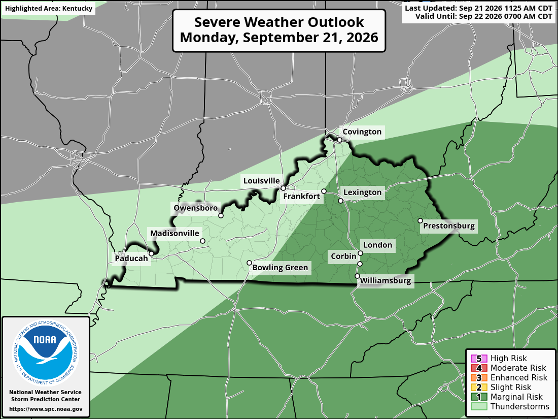
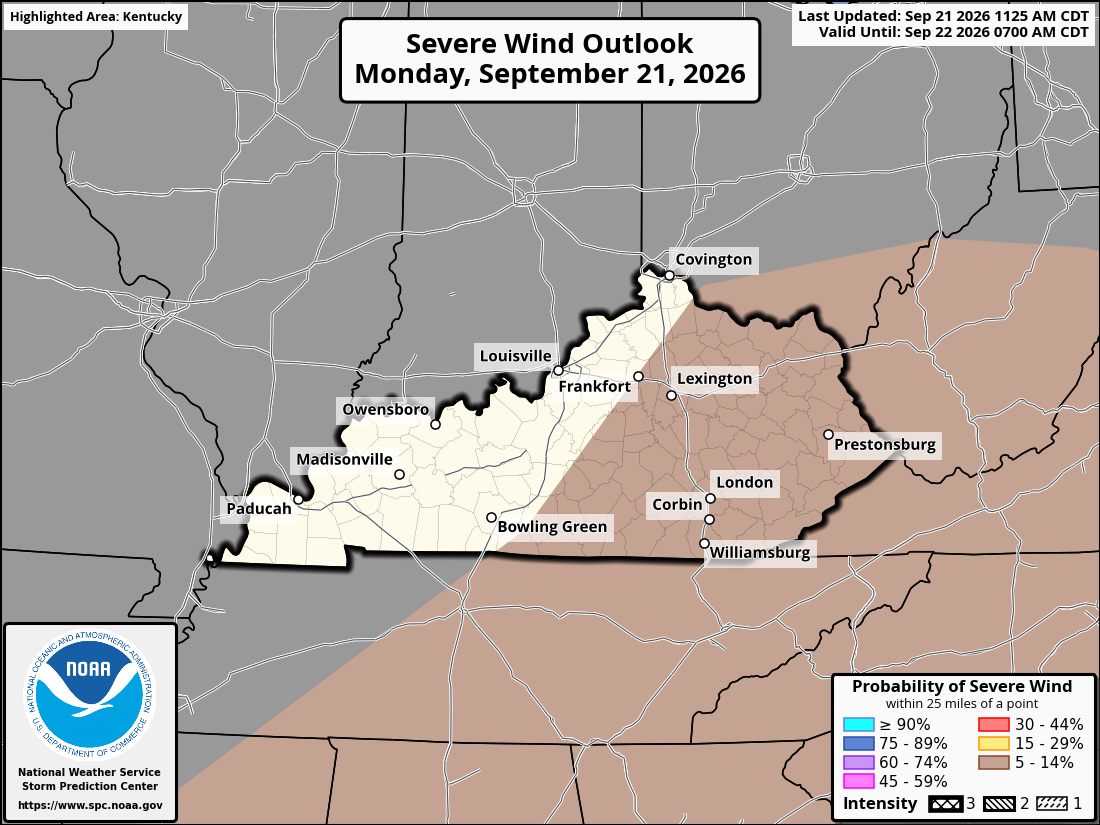
A cold front stretches from Virginia through northern Kentucky and into the southern Plains. The front will slowly move south today, bringing better chances for scattered showers and thunderstorms as warm, humid air builds instability. Across Kentucky, expect a mix of clouds and sunshine with scattered thunderstorms developing mainly this afternoon and evening. Southern and eastern Kentucky could see a little more storm activity, while northern Kentucky will have more hit-or-miss coverage. Most storms should remain below severe levels, but a few stronger storms could produce gusty winds around 50-60 mph, frequent lightning, and locally heavy rainfall. With plenty of moisture in the atmosphere, some storms could drop heavy rain in a short period of time. For the Cincinnati area, storm chances will be somewhat lower, but a few thunderstorms could develop during the afternoon and evening. The main concerns will be brief heavy rain, lightning, and gusty winds. Rain chances: 30-40% around Cincinnati and northern Kentucky, 40-50% across central and eastern Kentucky, and 50-60% across southern Kentucky.
-
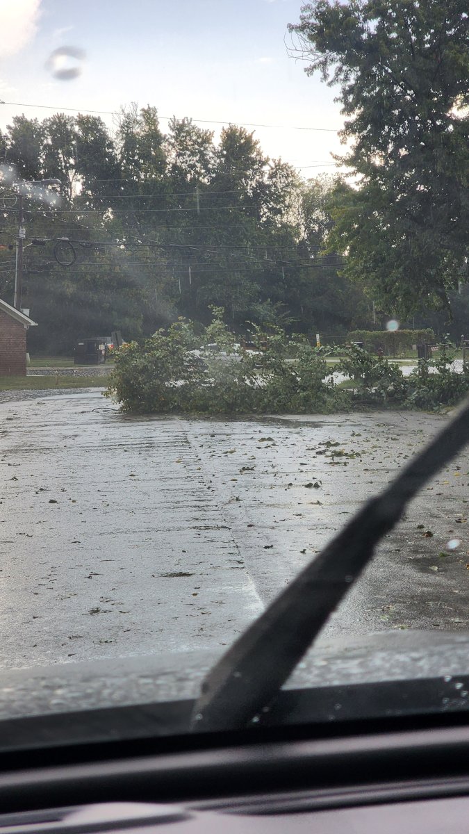
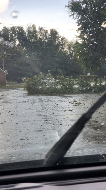
We've had some storm damage here in Richmond.

-
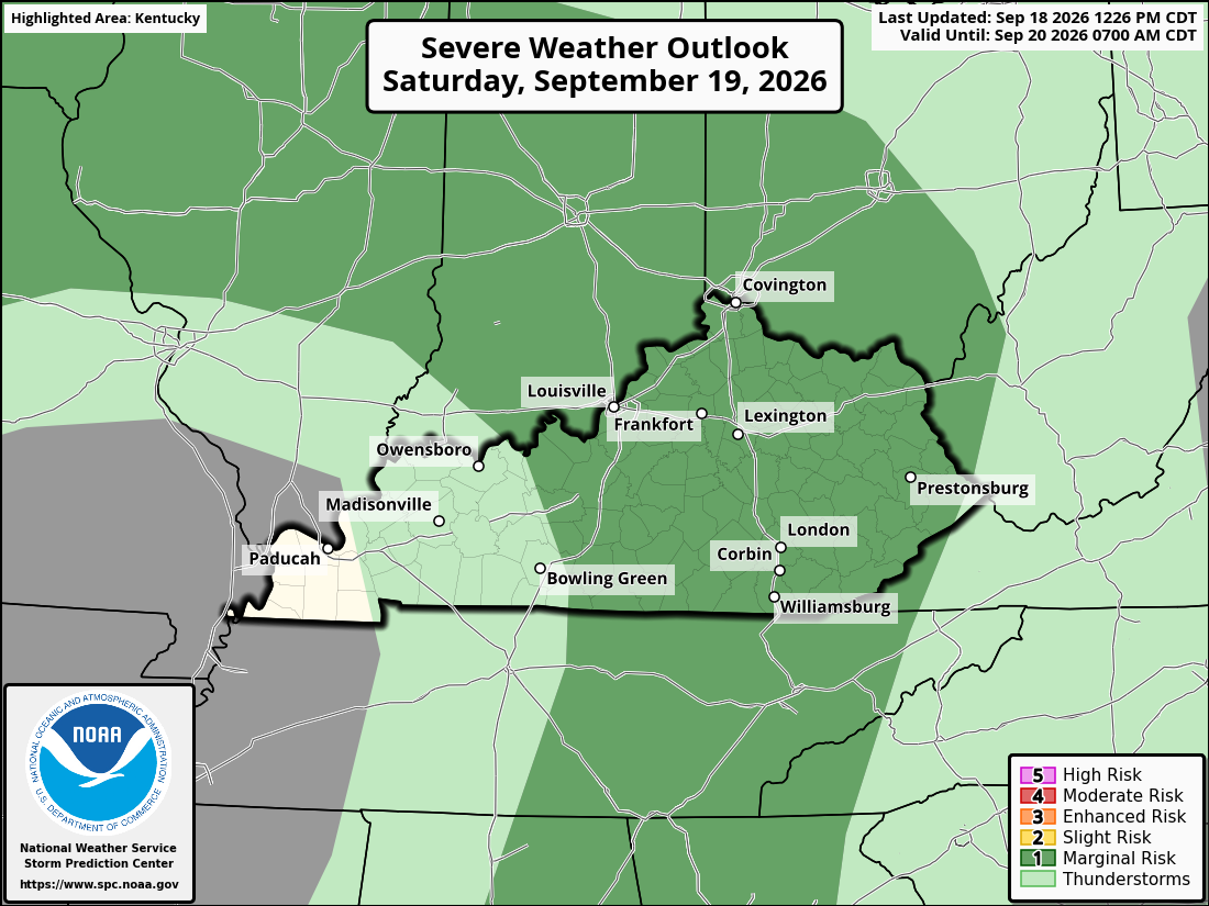
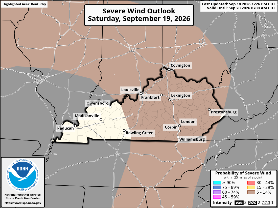
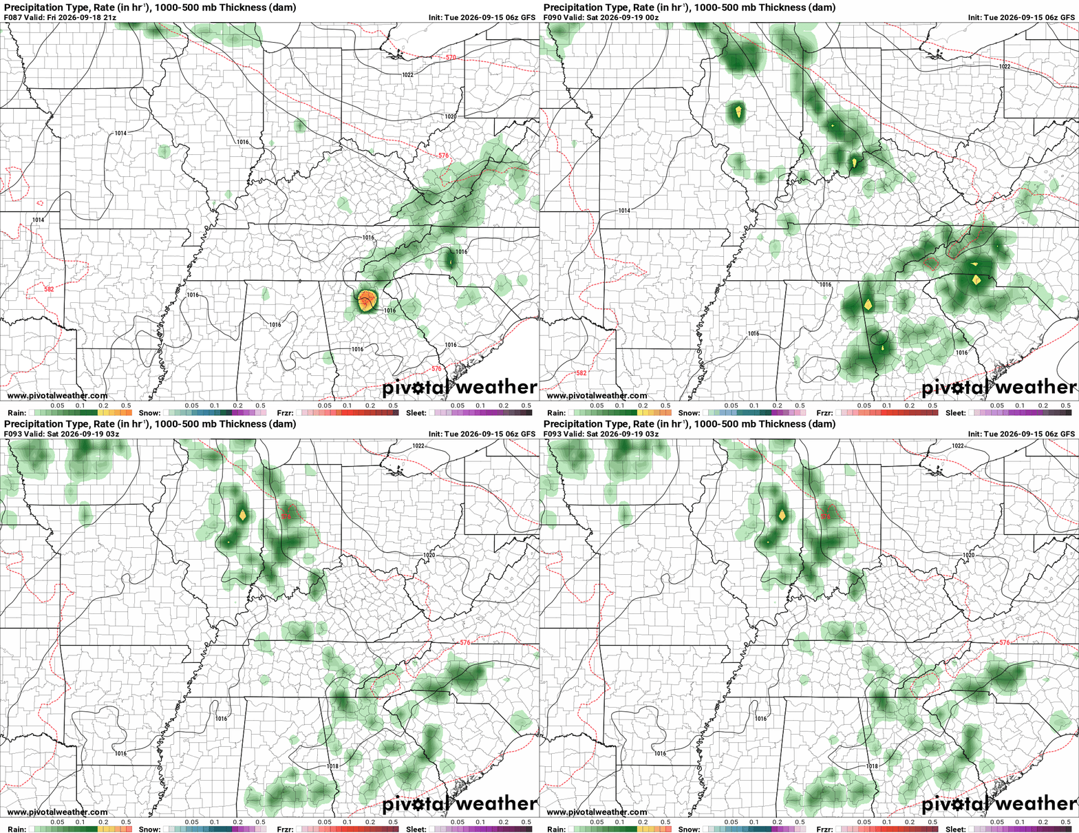
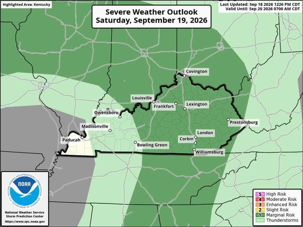
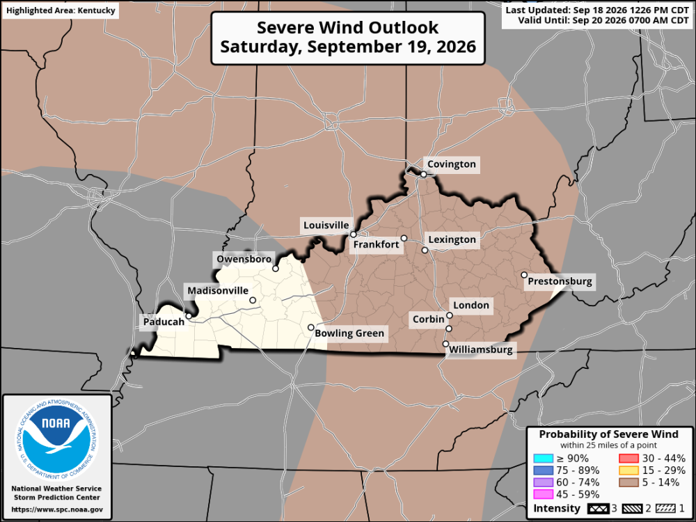
Warm and humid conditions will continue across Kentucky and the Cincinnati area Saturday. Skies will be partly cloudy, with scattered showers and thunderstorms possible during the afternoon and evening. Most locations will not see rain, but a few storms could become strong enough to produce gusty winds, brief heavy rainfall, and an isolated downburst. The timing and coverage of storms remain somewhat uncertain. High temperatures will reach the mid to upper 80s, with a few spots approaching 90 degrees. Overnight lows will fall into the upper 60s and lower 70s. Rain chances will generally be around 30 to 40 percent, mainly during the afternoon and evening.
-
Friday will be another hot and humid day across Kentucky, while the Cincinnati area will be a little cooler. A few showers and thunderstorms are possible, but most areas should stay dry for Friday night football. Western Kentucky: It will be hot, with afternoon highs reaching the mid to upper 90s. A stray thunderstorm is possible during the afternoon, but most of the area should remain dry. Temperatures will fall into the 70s Friday night. Central Kentucky: Expect highs in the lower to mid 90s with plenty of heat and humidity. There is a chance for a few afternoon thunderstorms, but the threat should decrease toward evening. Temperatures should be in the 70s around kickoff. Eastern Kentucky: Another hot and humid afternoon is expected, with highs generally in the upper 80s to lower 90s. A few thunderstorms could pop up during the afternoon or early evening. Temperatures will settle into the 70s for most Friday night games. Northern Kentucky and Cincinnati: The day should be noticeably cooler, with highs in the mid 80s. Showers and thunderstorms are possible earlier in the day, but conditions should improve heading into Friday evening. Temperatures will drop into the 60s and lower 70s during the games. Friday night football The good news for most teams and fans is that widespread rain isn't expected during the games. The bigger concerns will be the heat and humidity during afternoon activities, especially across Kentucky. A few isolated storms could still develop, so keeping an eye on the radar before kickoff is a good idea.
-
Friday will bring a warm and humid setup for high school football across Kentucky and the Cincinnati area. Temperatures will reach the 80s during the afternoon before easing through the 70s Friday evening. Western Kentucky should see afternoon highs in the mid to upper 80s, with temperatures in the upper 70s around kickoff. Rain chances will stay around 15-20%. Central Kentucky will reach the mid to upper 80s, with temperatures dropping into the mid to upper 70s during the games. Rain chances are around 15-25%. Eastern Kentucky should be a little cooler, with highs in the lower to mid 80s and temperatures falling through the 70s Friday evening. Rain chances will run around 20-30%. Northern Kentucky and the Cincinnati area should reach the mid 80s, with temperatures near 75-80° around kickoff before falling into the upper 60s and lower 70s later in the evening. Rain chances will be higher here, around 30-50%. Overall, most football games should avoid widespread rain, but a few showers or thunderstorms could develop. Any storm that moves across a game site could produce a quick downpour and gusty winds.
-
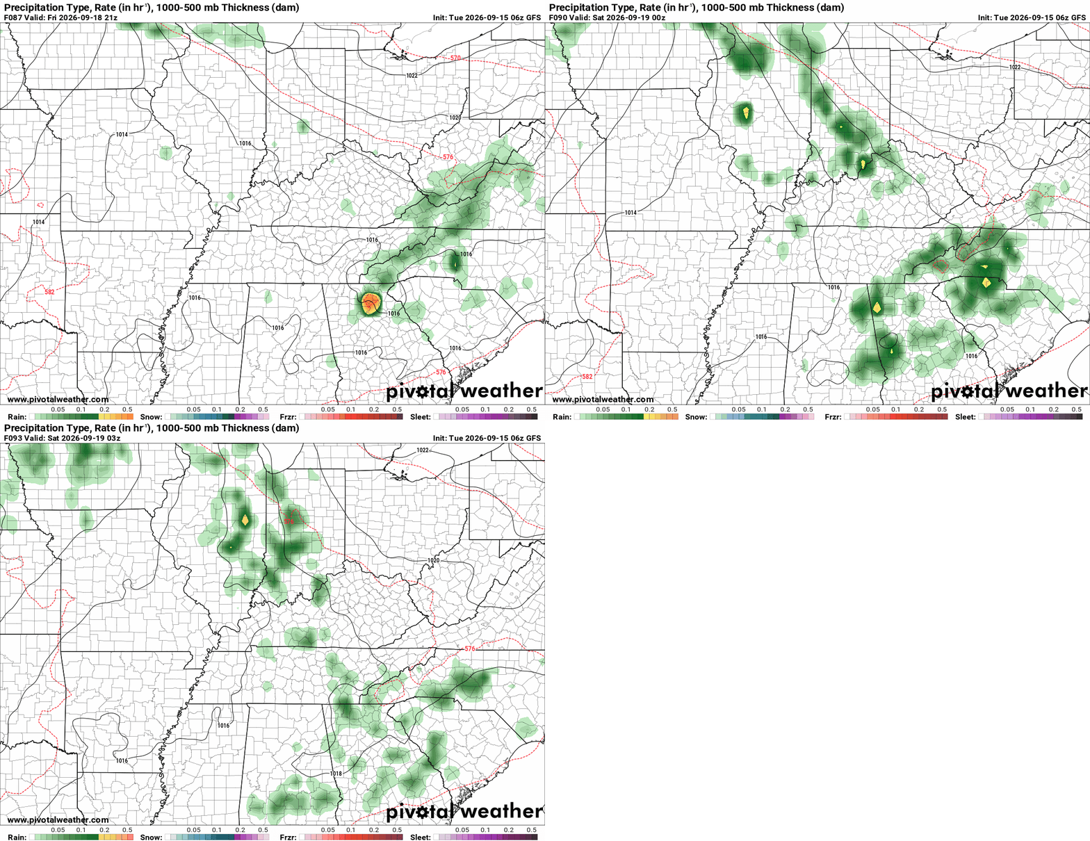
Friday looks like a pretty good night for high school football across Kentucky and the Cincinnati area. Warm and humid conditions are expected, with mostly sunny to partly cloudy skies during the day. A few isolated showers or thunderstorms could develop during the afternoon or evening, but most locations should remain dry. Rain chances will generally be around 10-30%, depending on the area. Regional Forecast Western Kentucky: Warm and humid, with mostly sunny skies. A stray afternoon or evening thunderstorm is possible. Rain chances around 10-20%. Central Kentucky: Mostly sunny to partly cloudy, with a chance of an isolated shower or thunderstorm. Rain chances around 20-30%. Eastern Kentucky: Warm and humid, with partly sunny skies and a few isolated showers or thunderstorms possible. Rain chances around 20-30%. Northern Kentucky: Mostly sunny early, becoming partly cloudy. A slight chance of showers or thunderstorms during the afternoon or evening. Rain chances around 20%. Cincinnati Area: Mostly sunny to partly cloudy, with a slight chance of an afternoon or evening shower or thunderstorm. Rain chances around 20%.
-
El Niño is expected to strengthen through the end of the year, and that could have an impact on the weather across Kentucky and the Cincinnati area this fall and winter. p The latest outlook points toward a potentially historic El Niño event. While that doesn't tell us exactly what every storm or cold front will bring, it does give forecasters an idea of the pattern we could see as winter approaches. For Kentucky and Cincinnati, the winter could lean milder than normal overall, with precipitation potentially running below average. That said, a mild winter doesn't mean we can forget about snow or ice. All it takes is a few well-timed storms and enough cold air in place to produce a significant winter weather event. Fall will likely bring the usual ups and downs in temperatures, with summer warmth hanging on at times before colder air becomes more common later in the season. By November and December, the larger weather pattern may begin to show more of El Niño's influence. Eastern Kentucky, especially the higher elevations, could see more opportunities for snow when colder air and moisture come together. Central and western Kentucky, along with the Cincinnati area, will likely see a mix of mild stretches, cold fronts, and occasional winter weather threats. We'll have more clarity on the season as we approach winter.
-
Warm and humid conditions are expected across Kentucky and the Cincinnati area Friday night. A mix of clouds and sunshine will be around during the day, with a few showers or thunderstorms possible. Temperatures should be in the upper 70s to around 80 degrees for kickoff. Most games should stay dry, although an isolated shower or storm could affect a few locations. Overall, Friday night looks favorable for football, with humidity being the main issue. Widespread rain or severe weather is not expected.
-
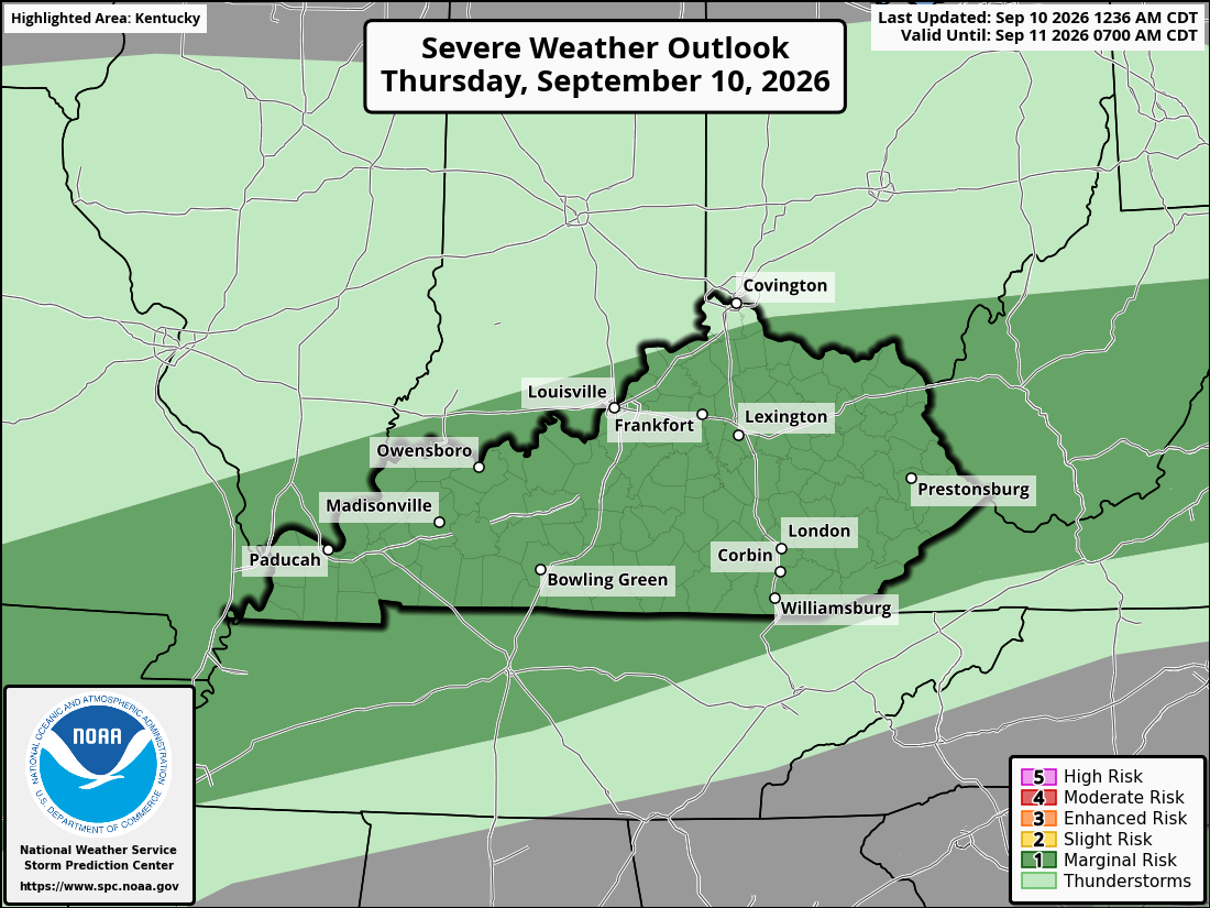
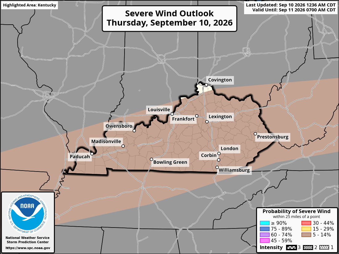
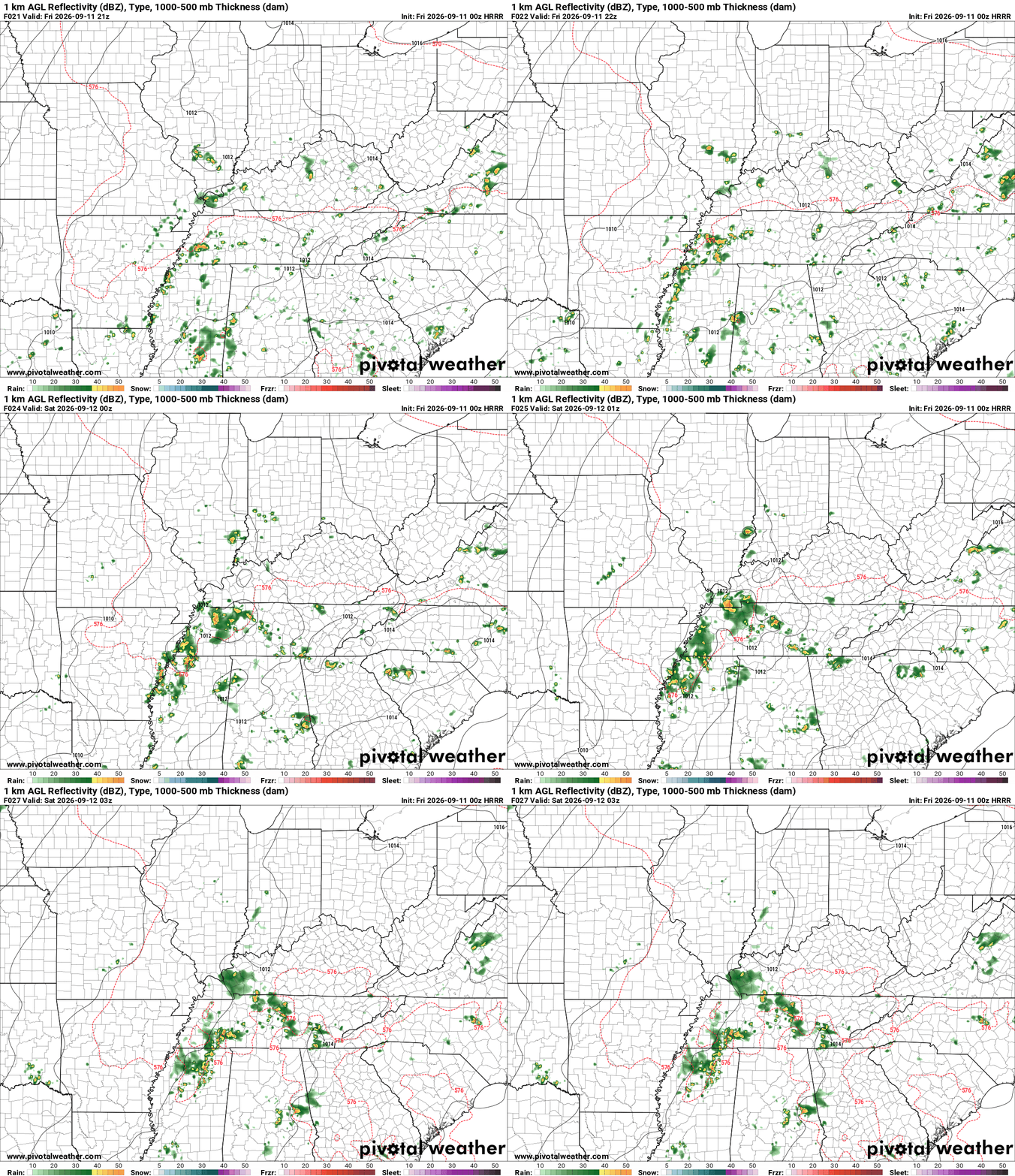
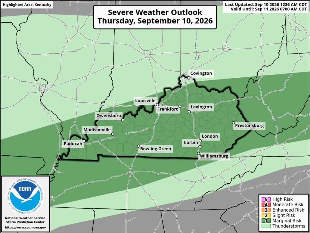
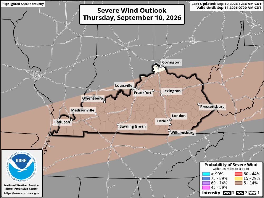
Thursday will be another hot and humid day across Kentucky and the Cincinnati area, with afternoon temperatures reaching the upper 80s to middle 90s. Dewpoints in the 60s and 70s will make it feel muggy, especially during the afternoon. Scattered thunderstorms will become more likely during the afternoon as a front and a couple of upper-level disturbances move through the region. Storm coverage should increase through the afternoon and continue into the early evening. Most storms will remain below severe limits, but a few could become strong. The main concern will be gusty to damaging winds, especially from storms that grow into larger clusters. There is enough instability and wind shear for a few storms to become organized. For Cincinnati and northern Kentucky, the better chance for storms comes during the afternoon and early evening. Central and eastern Kentucky will also have scattered storm chances, with temperatures remaining quite warm. Overall, expect a hot, humid Thursday with scattered thunderstorms developing during the afternoon. A few strong storms are possible, but widespread severe weather is not expected.
-
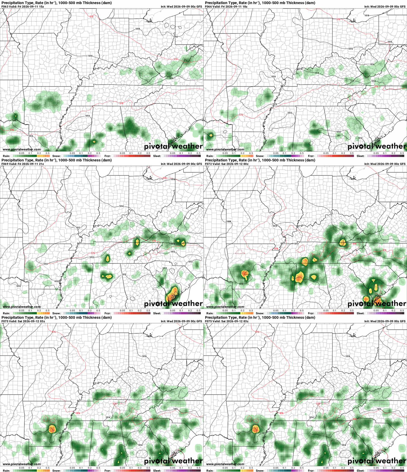
Friday night looks like a pretty comfortable night for football. Clouds will hang around, and humidity will remain noticeable, but temperatures will be much more manageable than earlier in the week. Western Kentucky: Mostly cloudy and humid with a few showers possible. Temperatures near 80 at kickoff, falling through the 70s. Central Kentucky: Mostly cloudy with a few showers possible, especially early. Temperatures in the upper 70s to around 80s at kickoff, falling into the lower 70s. Eastern Kentucky: Cloudy and damp at times, with a few showers possible. Temperatures are mainly in the 70s at kickoff. Northern Kentucky: Mostly cloudy and generally dry. Temperatures in the upper 70s at kickoff, falling through the 70s.
-
Friday night is looking pretty good overall for high school football across Kentucky. While there could be some showers around earlier in the day, conditions should gradually improve heading into the evening. Western Kentucky Things should be improving by kickoff, with a warm evening and a mix of clouds and clearing skies. Most games should stay dry. Temperatures will likely start in the low to mid-80s and fall into the 70s as the night goes on. Central Kentucky Central Kentucky should see improving weather heading into Friday evening. It will be warm and somewhat humid at kickoff, but temperatures will gradually become more comfortable during the game. Most areas should stay dry. Eastern Kentucky Eastern Kentucky may hold onto clouds and a few showers longer than the rest of the state. An isolated shower could still linger into the evening, so this will be the region to keep an eye on. Otherwise, temperatures should be mainly in the upper 70s to lower 80s at kickoff. Northern Kentucky Northern Kentucky should have a warm and generally dry evening for football. Temperatures will gradually fall through the 70s as the games move into the later quarters.
-
nWo changed their profile photo
-
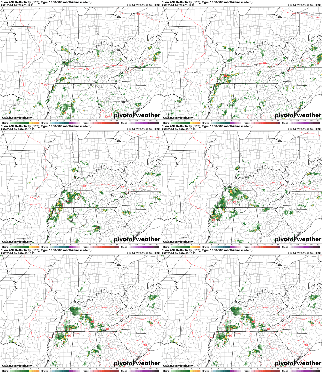
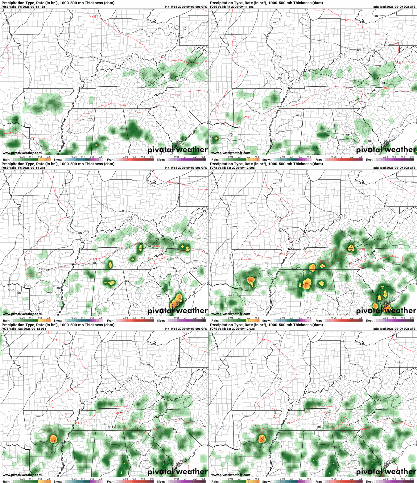
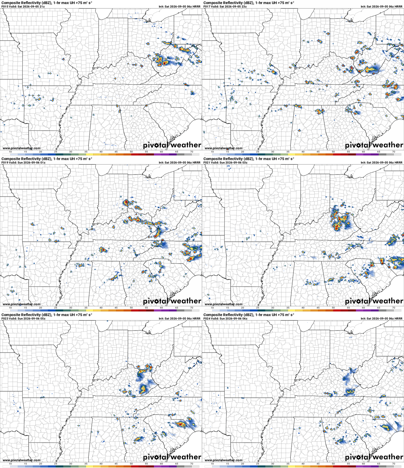
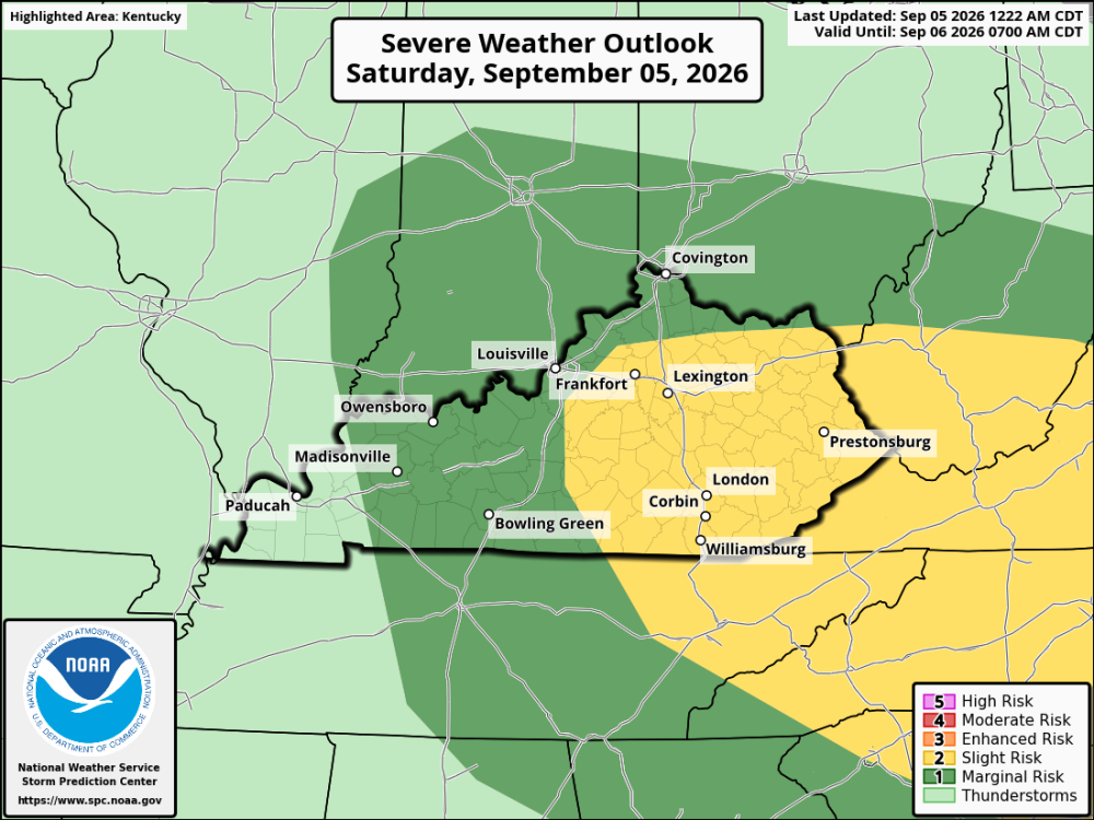
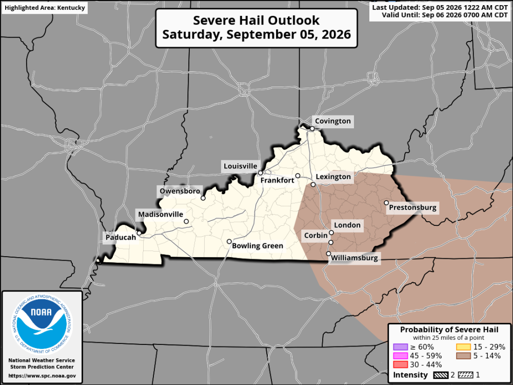
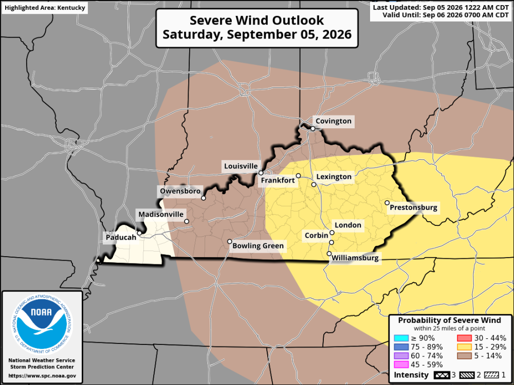
Saturday looks like it could be a busy weather day across Kentucky and the Cincinnati area. Some thunderstorms may already be around Saturday morning, especially across parts of Northern and Eastern Kentucky and the Ohio Valley. These storms could be weakening as the morning goes on, but if they stay together, a few could still produce strong wind gusts and heavy rain. The heat will quickly become part of the story during the afternoon. Temperatures are expected to climb into the 90s, with some spots getting close to 100 degrees. Add in the humidity, and the atmosphere will have plenty of energy for more thunderstorms to develop. Another round of storms could fire up during the afternoon and continue into the evening. The strongest storms could produce damaging straight-line winds, which appear to be the main severe weather concern. Heavy downpours, frequent lightning, and brief flooding in poor-drainage areas are also possible. Northern Kentucky and the Cincinnati area will also need to keep an eye on the sky. Storms near the Ohio River could become strong, and some may produce damaging wind gusts as they move through the region. It will be hot and humid Saturday, with thunderstorms becoming more likely as the day goes on. Not everyone will get a storm, but the storms that do develop could be strong to severe. The HRRR shows isolated to scattered storms starting up around 5 pm EDT, with chances of storms until early Sunday morning.
-
Severe Thunderstorm now headed towards the Cincinnati area from the northwest.
-
Scattered thunderstorms are popping up mainly south of I-64. There is now a severe thunderstorm warning for Estill County.
-
Saturday will be hot and humid across Kentucky and Cincinnati, with thunderstorms becoming possible during the afternoon and evening. The best chance for stronger storms will be across eastern Kentucky. The day's heat will help storms develop, and while widespread severe weather is not expected, a few storms could produce strong wind gusts and possibly localized wind damage. Heavy rain and frequent lightning will also be concerns. Central Kentucky, including Lexington and Richmond, will be hot for much of the day. A scattered thunderstorm could pop up during the afternoon or evening, but many areas may stay dry. Western Kentucky will also be hot, with only isolated storms around during the day. Northern Kentucky and Cincinnati can expect hot, humid conditions, with a chance of a few thunderstorms later in the day. Any storm could bring a quick downpour, lightning, and gusty